
Urban density mapping
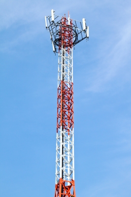
It might be possible to estimate the population density in urban areas on an hourly basis using data of call volumes through cellphone masts. The estimation would guide disaster impact assessments after a hazard event has occurred. The process would also allow for accurate placement of disaster response equipment and resources in proximity to the expected high impact areas.
If cell mast data had existed and been made available during the earthquake response in Haiti. Search and rescue teams could have prioritised areas which had a higher population density at the time of the quake. They wouls also have known where people are likely to go for information on lost relatives and friends as these are likely to be the most densely populated areas.
The data collected would provide a population density estimation based on the radius of the mast coverage. Dependent on cellular communication behaviour, it is likely that a real-time disaster damage assessment would be available through the analysis of network call volumes at and immediately after the hazard event. By identifying cellular communication masts which are not transmitting data and those which are operating at higher capacity in proximity to the event, an informed impact assessment can be undertaken.
0 comments