
"Just In Time" Disaster Registry
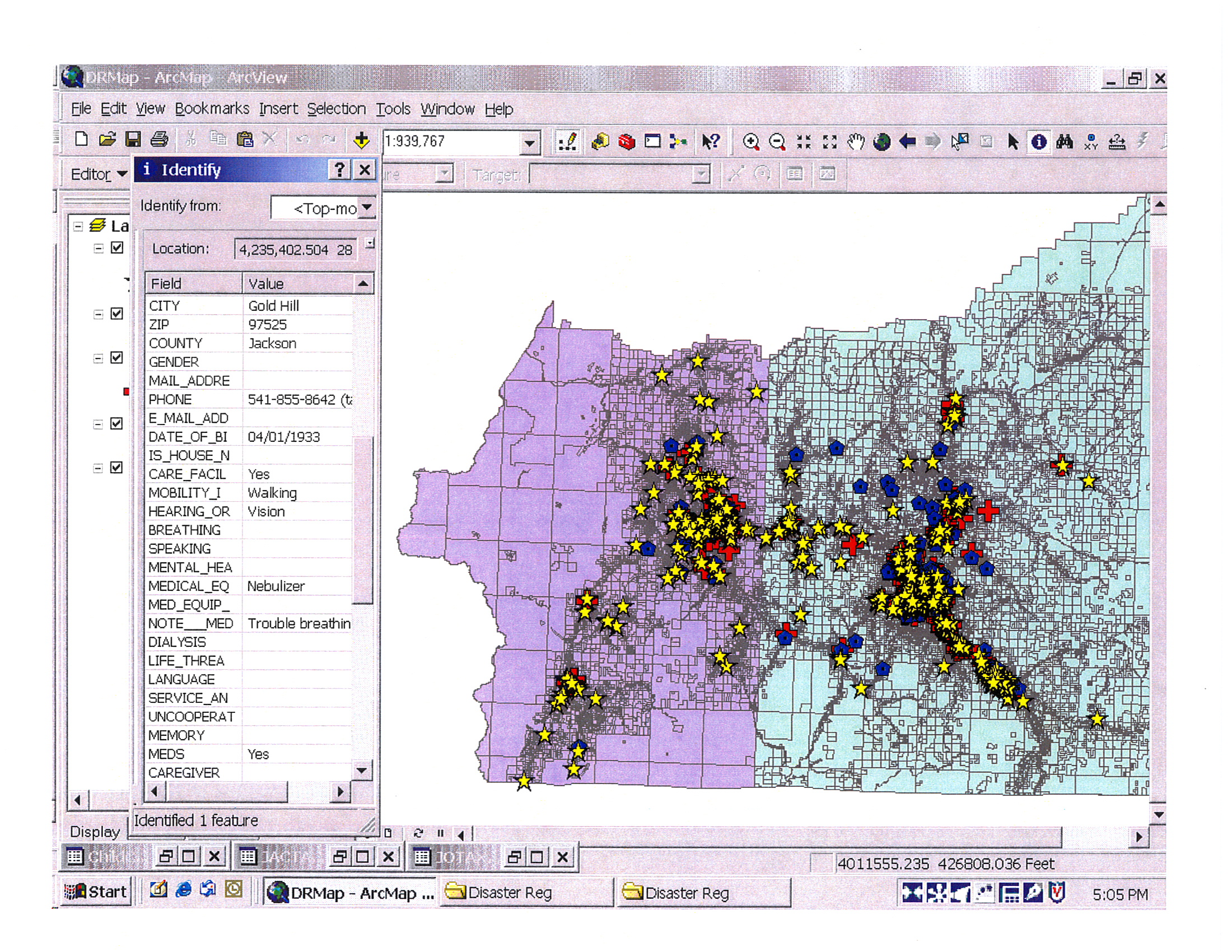
Jackson and Josephine Counties Oregon have had an active Disaster Registry since 2002, based on an Access database and ArcGIS mapping software. It is maintained by volunteers who phone everyone in the 600-person database once a quarter. In addition to the layer of vulnerable people, we maintain layers of residential care facilities and child care facilities using licensing lists for updates.
We discovered that the same GIS Locators we use to geocode our data could be used by our local Medicaid transportation brokerage and paratransit provider to map everyone in its databases. The list of thousands of Medicaid-eligible people is updated daily by the state. With some preparatory work ahead of time, addresses of people with special transportation needs can be coded for mapping. For planning purposes the addresses can be used without personal identifying information (addressing HIPAA concerns). Planners can visualize areas of high density of people needing rides relative to flood zones or other hazards. During an event, GIS-trained individuals can pull up a map quickly that includes names and phone numbers for evacuation purposes.
This is a practice that could be duplicated in many places, since Medicaid pays for medical rides everywhere in the country and eligibility data is always current.
Requirements are simple compared with ongoing maintenance of a registry built on applications: 1) a full version of ESRI ArcGIS or another GIS program capable of creating locators; 2) a current database with accurate addresses in proper format; and 3) a GIS programmer/consultant who can create the locators based on the available data layers for the jurisdiction and then train tranist agency staff to activate the registry.
Note: The photo shows a map of our on-going Disaster Registry. The "Just In Time" Registry could be formatted similarly to indicate transportation needs.
0 comments